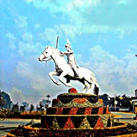
Kot Addu is situated just east of the River Indus in the southern part of Punjab, Pakistan. It is a town and tehsil in the district of Muzaffargarh. The area is situated almost at the center of Pakistan and is approximately 100 km from Multan, 80 km from D.G.Khan, 60 km from Muzaffargarh, 60 km from Layyah, and 16 km from Taunsa Barrage.
The town is subdivided into 28 Union Councils. This city is well-known for its public parks and is also a center of culture and literature. A vast collection of ancient books is stored inside an integrated network of many libraries.
Kot Adu is the birthplace of many renowned artists, politicians, and other historical figures, such as the Pathany Khan, Mikha Singh, and late Shri Chandragupta Vidyalankar, a famous Hindi writer. This article has every detail about the Tehsil including, Kot Addu History.
| Title | Description |
|---|---|
| Information | |
| Location: | Pakistan |
| In Urdu : | كوٹ ادُّو |
| City Council: | Government of Punjab |
| Type: | It is located in the southern part of the Punjab province |
| Local Language Name: | Seraiki,Urdu,Punjabi |
| Coordinates : | 30°27′59″N 70°57′56″E |
| Elevation: | N 30° 28′ 34 E 70° 57′ 52 |
| Union councils: | 28 |
| Language | |
| Official Language: | Urdu |
| Native Language: | Punjabi |
| Other Languages: | Urdu.Punjabi.English |
| Government | |
| Type: | Government Of Punjab |
| Area | |
| City: | 4,24,521 |
| Total Area: | 8,77,989 |
| Population | |
| Total Population: | 8,08,438 |
| Time zone | |
| Time zone: | PST (UTC+5) |
| Codes | |
| Postal code: | 34050 |
| Dialing code: | 697 |
| Vehicle registration: | Three letters beginning with K and random four numbers |
Table of Contents
Kot Addu History
Kot Adu is an ancient and historical city. Throughout history, it is well-known for its beauty and peacefulness. The town was established in the year 1500 by the Merani chief, Adu Khan. To safeguard its citizens from invaders, he constructed a bastion-wall around the city.
The region was initially known as Adduda Kot. It was part of the Mughal Empire until 1849. During this period, the Mughals appointed Afghan Pashtuns to govern this region. In 1849, it was captured by the British Empire and remained under their control till 1947.
Geography
The Tehsil is the geographical center of Pakistan with coordinates 30°N (latitude) 70°E (longitude). Geographically the landscape-structure is flat, and the total area in length is 3553.1 km2. The flat plain area is favorable for agriculture, and almost 50% of the total area is used for cultivation. The region is 430 ft. above sea level.
Kot Addu Climate
The area is mainly dry and sunny. The summers are long, sweltering, humid, and clear that lasts approximately 4.1 months. The temperature usually ranges from 45°F to 107°F. It was one of the regions where the top 10 hottest temperatures were recorded. The river Indus is on one side of this area, and Thar’s desert is on the other.
This landscape makes the area prone to storms and floods. The winters are short, cold, and mostly clear that lasts for approximately 2.8 months, during which the average high temperature never goes above 76°F. The rainy period of the year lasts for 7.2 months, with an average rainfall of 127mm.
Population
According to the 2017 census, the area is home to 808438 people. It is Pakistan’s 67th largest city with a population density of 425.5/km2.
Culture
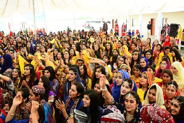
Saraiki’s cultural values dominate the area. The area is rich in heritage and traditions of various cultures, with a blend of traditional Punjabi customs. The influencing culture of neighboring Multan is prominent. Multicultural festivities are cherished and celebrated regularly.
Natives commonly wear traditional clothes such as kurta, shalwar, dhoti, shoulder chadar, traditional cap or turban, and dupatta. Throughout the area, fast food shops are available where traditional and non-traditional food goods attract people. The food street provides plenty of delicious food items of all kinds.
Education
More people are literate and educated in the district as compared to their neighboring regions. People from nearby towns come here for education. There are several reputed educational institutions in the region, such as Technical College, Kot Addu. Some of the prominent institutions include:
- Superior college
- Allied School
- The Educators
- STARS Groups of Colleges
- College for Elementary Teachers
- Crescent College of Education
- Punjab College of Physical Education
- Punjab Group of Colleges
- Post Graduate College
- Virtual University, Kot Addu Campus
Sports
Activities in sports primarily include:
- Cricket
- Hokey
- Football
- Horse Riding
- Bull Race
- Wrestling
Economy
The industrial and commercial sector in Kot Adu plays a significant role in Pakistan’s economy. Its economic contribution to its economic development and its GDP is substantial.
Industry
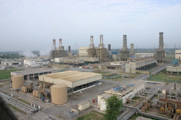
It is a central industrial and commercial area, the second-largest after Faisalabad. Industries located in the industrial zone provide jobs for their residents and the neighboring cities.
Prominent industries include cotton mills, where sugar mills such as Sheikhoo Sugar Mill and Fatima Sugar Mill are located. Power stations such as Kot Adu Power Company (KAPCO) and Lal-Peer Thermal Power Station provide Pakistan with a large electricity share. The Pak Arab Oil Refinery (PARCO), Pakistan’s largest oil refinery, is located here.
In addition to these, there are also foundries and mills in this region. Salient mills include cotton, silk, and woolen textile, Gellani flour, rice, and oil. It is renowned for its crafts and small and cottage industries for Kundan work embroidery. Information Technology (I.T.) industry in Kot Addu is also booming.
Agriculture
Kot Adu is a significantly fertile area for agriculture. Two main canals cross Kot Addu, supplying water from the Indus River (Muzaffar, T.P. link) and eight sub-canals. An abundant supply of water for irrigation makes the land highly conducive for cultivation.
Crops
The main crops grown in the district are wheat, cotton, sugarcane, rice, maize, tobacco, Bajra, Moong, Mash, Masoor, and oilseeds such as Rape/Mustard, and Sun Flower are also cultivated here.
Fruits
Lush green farms of fruits such as mangoes, citrus, guavas, and pomegranates are prominent in the outskirts. In addition, Dates, Jaman, pears, falsa, and banana are cultivated in small quantities.
Tourism
Because of the Indus river and public gardens, among other items, the city attracts a large number of tourists every year. The best times to visit are the first quarter of the year, i.e., between and January and March, and the last quarter, i.e., between and October and December.
Worth visiting places for tourists include:
- Tomb Shah Ali Akbar
- United Mall
- Multan Arts Council
- Shrine of Mai Maharban
- Clock Plaza
- Fort Kohna
- Shrine of Hazarat Din Pinna
- Tomb Shah Rukne Alam
- Shrine Khawaja Awais Kagha
- Shrine of Hazarat Noor Shah Talai
Languages
Inhabitants can speak and understand:
- Saraiki
- Punjabi
- Urdu
- English
Travel
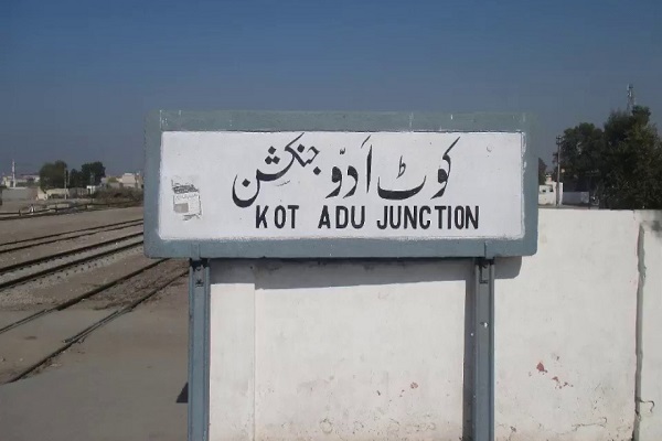
People can travel to and from Kot Addu by road, train, and plane to the nearest airports. Several bus services are operating all over the country to reach General Bus Stand. Trains from all the major cities of Pakistan arrive here. People traveling by train can embark and disembark at Kot Adu Junction railway station.
Airports near the city include:
- Multan International Airport (MUX), 52 km
- Dera Ghazi Khan Airport (DEA), 72 km
- Ouzkani Airport, 76 km
- Belab Airport, 42 km
Kot Addu Postal Code and Area
Postal Code: 34050
Area Code: 066
Zip Code: 34030
