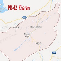
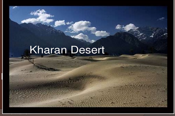
Kharan is situated in the northeastern part of Balochistan and 294.40 km from the provincial capital, Quetta. Desert Kharan is one of the best deserts in Balochistan. The district consists of 09 union councils and one tehsil and is well-known for its mountainous desert.
The region is also famous for being the site of Pakistan’s second neural test performed on the 30th of May, 1998, in the Kharan desert. There are two rivers in the district, the Boddo river, and the Mashkel river. The town derives its name from the Persian word Khar which means Thorn, because, in the past, this region was full of thorny plants. This article has every detail about the region, including Kharan history.
| Title | Description |
|---|---|
| Information | |
| Location: | Pakistan |
| In Urdu: | خاران |
| In Urdu: | خاران |
| City Council: | Government Of Balochistan |
| Type: | Town in Kharan District |
| Local Language Name: | Balochi |
| Province: | Balochistan Pakistan |
| Coordinates : | 28°35’0N 65°25’0E |
| District: | Kharan District |
| Region: | Balochistan |
| First settled: | March 15, 1952 |
| Elevation: | 692 m (2,270 ft) |
| Union councils: | 1 |
| Language | |
| Official Language: | Urdu |
| Native Language: | Brahvi |
| Other Languages: | Urdu,Brahvi,English |
| Government | |
| Type: | Government Of Balochistan |
| Area | |
| Total Area: | 8,958 km2 (3,459 sq mi) |
| Population | |
| Density: | 10.81/km2 (28.0/sq mi) |
| Total Population: | 96,900 |
| Time zone | |
| Time zone: | PST (UTC+5) |
| Codes | |
| Postal code: | 94100 |
| Dialing code: | 847 |
| Vehicle registration: | Three letters beginning with K and random four numbers |
Table of Contents
Kharan History
Kharan is a historic place that has seen many cultures. In 1383 Miran Shah, the son of Timur, conquered this region. Mir Muhammad Khan Nousherwani (1650) was the first ruler of the Nousherwani dynasty in Kharan that lasted until 1958. It was established in 1697 as a vassal state of Kalat (princely state).
Iran attacked this region in 1726, and Nousherwanis fought many wars to gain control of the region. In 1940, before the partition of the sub-continent, the region withdrew its status as Kalat’s vassal. On the 17th of March 1948, it acceded to Pakistan, and on the 3rd of October 1952 joins BSU (Balochistan States Union).
On the 14th of October 1955, when other regions were integrating to form the province of West Pakistan, the state status of Kharan was dissolved. The government of Pakistan designated this region as a district in 1970.
Geography
The Geographical coordinates are at 28°35’ N (latitude), 65°25’ E (longitude), and the town is 2273 ft. (692 m) above sea level. Its total area is 10,705 km2 in length.
Kharan Climate
Due to its geographical location and terrain, the climate is mostly dry. Desert sand dust storms frequently hit this area. Summers are generally sweltering hot during the day, but nights are relatively cold and pleasant.
During the hot season, the daily average temperature may reach as high as 42.5°C. The winters are cold and dry, with an average temperature of 2.4°C. The average annual rainfall is approximately 100 mm.
Population
The district is home to 44,655 residents, according to the 2017 census, and it is a thinly populated region with a population density of 14.59 /km2 (9.06/sq. mi). The city’s population makes it the 16th most populated city in Balochistan.
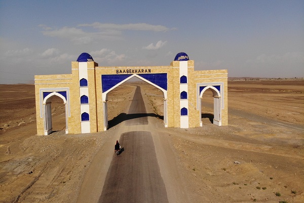
Kharan Culture
Kharan society is a combination of several communities, but Balochi culture is dominant, deep-rooted, and diverse. People cherish and celebrate their traditional folk music, dance, and folklores. People are fond of consuming wheat, rice, millet, Saji, lassi, dates, and lamb & camel meat.
Their main attire is long and baggy traditional shalwar-kurta. Women’s dresses are famous for the artwork of small mirrors and embroidery on clothes. In some areas, people still live in mud houses.
Kharan Education
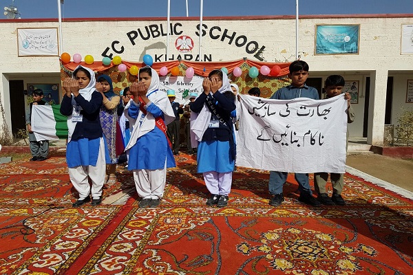
According to the data published by Alif Ailaan in Pakistan District Education Rankings 2017, district is at 110th position out of 141 districts. Education in the community is struggling to compete with the rest of the areas. There are 224 (Boys: 168, Girls: 56) schools in this district. A list of some educational institutions is as under:
- Boys primary school, Kandora Gul Muhammad
- Boys primary school, Killi Shah Mohd (Daray Khan)
- Boys primary school, Noor Mohammad Butt
- Boys primary school, Tuskain
- Boys primary school, Wapda Colony
- Girls Primary School Gozagi
- Girls Primary School Kainan Dad Khuda
- Boys High School, Bedian
- Boys High School, Ward No. 7 Kharan
- Boys High School, Ward No. 4 Kharan
- Boys High School, Kunari
- Boys High School, Lijji
- Boys Middle School, Babgulzai
- Boys Middle School, Danno
- Boys Middle School, Eri Kalag
- Boys Middle School, Gazzi
- Boys Middle School, Killi Machhi
- Government Boys College Degree
- Government Girl’s Inter College
- Balochistan Residential College
- Balochistan Residential College BRC
- University of Balochistan Sub Campus
- Cadet College
- C Public School
- Balochistan Grammar School
- Kharan University
Sports
Football is the most favorite sport in the district. Other sports are also played, such as:
- Cricket
- Hockey
- Boxing
- Swimming
- Horse Riding
Economy
The economy is heavily dependent on agriculture, and the district’s share in the overall economic growth of Pakistan is minor.
Industry
Rug and carpet making, along with some cottage industry, constitute the district’s industrial zone.
Agriculture
The primary source of income and livelihood is agriculture. The soil is conducive for cultivating cotton, barley, cumin, chilies, millet, mung bean, wheat, lentil, sorghum, sunflower, maize, mustard, mash bean, fodder, and a variety of vegetables. Livestock breeding is another source of income in the district.
Major fruit cultivation includes melons, apple, chico, pear, apricot, plum, dates, grapes, pomegranate, citrus, peach, and almond. The district is also well-known for rug and carpet making.
Tourism
Barren and rugged mountains and sandy deserts make this city a serene tourist spot. Tourists attraction include:
- Raskoh Vally
- Nausherwani Tombs
- Kharan Desert
- Khanate of Kharan
- Sheikh Zayed Bin Waleed Mosque
Kharan Languages
Natives of this region can speak and understand:
- Balochi
- Brahuvi
- Persian
- Urdu
Travel
National Highway N-25 and Basima Kharan Road connect the city with the outside regions. Many transport services are running in this region to bring and forth travelers by road. The small domestic airport, Kharan Airport (ICAO Code: OPKN), is located in this region. Nearest airports to the city are:
- Panjgur Airport (PJG), 220.82 km
- Quetta International Airport (UET), 236.86 km
- Mohenjo-Daro Airport (MJD), 301.58 km
Kharan Postal Code
Postal Code: 94100
Area Code: 847
