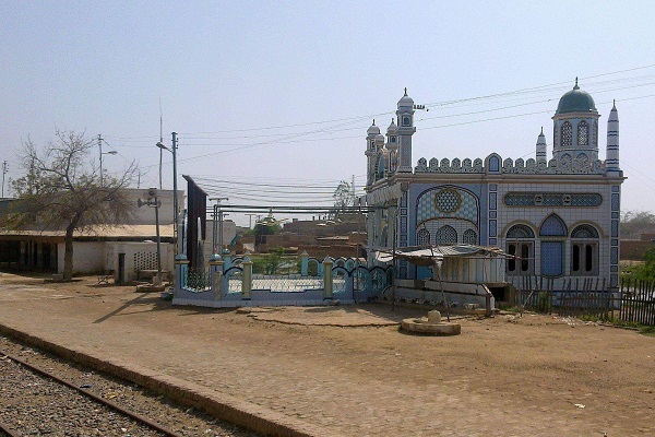
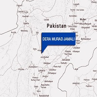
Dera Murad Jamali is situated in Naseerabad district, Balochistan province. This city is also the headquarter of the district. On the political map of Pakistan, it is located in the eastern part of the country. The city is 21km from Jacobabad, 109 km from Larkana, 112 km from Sukkar, and 212 km from Quetta city, Balochistan’s provincial capital.
Rural lifestyle prevails in the district. Various tribes communicate and live together in harmony. The city name is attributed to MirMuhammad Murad Jamali, a strong proponent and ally of Muhammad Ali Jinnah, the Pakitan founder.
As a political leader of Balochistan and the Pakistan Muslim League’s political worker, he dedicated his life to Balochistan and its people. He was assassinated for his efforts for progressive Balochistan. This article has all the details about the district including Dera Murad Jamali History.
| Title | Description |
|---|---|
| Information | |
| Location: | Pakistan |
| In Urdu : | ڈیرہ مراد جمالی |
| City Council: | Government Of Balochistan |
| Type: | City located in Nasirabad District |
| Local Language Name: | Sindhi,Brohi, Saraiki and Balochi |
| Province: | Balochistan Pakistan |
| Coordinates : | 28°32′40″N 68°13′14″E |
| District: | Nasirabad District |
| Region: | Balochistan |
| First settled: | 1974 |
| Union councils: | 31 |
| Language | |
| Official Language: | Urdu |
| Native Language: | Balochi |
| Other Languages: | Urdu,Balochi,English |
| Government | |
| Type: | Government Of Balochistan |
| Mayor: | Sardar Changaiz Khan Sasoli |
| Assistant Commissioner: | Naseer Nasar |
| Area | |
| Total Area: | 3,387 km2 (1,308 sq mi) |
| Population | |
| Total Population: | 350,000 in 2005 |
| Time zone | |
| Time zone: | PST (UTC+5) |
| Codes | |
| Postal code: | 80700 |
| Dialing code: | 7050 |
| Vehicle registration: | Three letters beginning with D and random four numbers |
Table of Contents
Dera Murad Jamali History
Dera Murad Jamali is an ancient city. There are cultural legends associated with this district. Impressions and impacts of early Sindh civilizations can be observed in this area as it is close to the province of Sindh. During the reign of the British Empire, the district name was Dera Temple or Place of Temple.
In some regional languages, the word Dera means boarding place. Captain H. M. Temple was a British civil servant appointed by the Britsh Government as the Political Agent (1891 – 1892). Indigenous people used to call it Dera Tippiul in their dialect.
In 1974, the town was named as a district. This town was also known as Tamboo District for three years (1987 – 1990) because of its proximity to Tamboo’s neighboring village, 40 km to the West. Despite being underdeveloped and less privileged, this city is the birthplace (1944) of Mir Zafarullah Khan Jamali, the 15th Prime Minister of the Islamic Republic of Pakistan.
Geography
The geographical coordinates of this region are at 28.55° N (latitude), 68.21°E (longitude), and 62m (2013.41ft) above sea level. Its total area is 2,445 km2 in length.
Dera Murad Jamali Weather
In this part of Balochistan, the hot and desert-like arid climate prevails. The average temperature ranges from 26 ° C to 39 ° C during the summer and from 8° C to 20° C during the winter. The rainy season is also recorded with an annual 40 mm (1.5 in of precipitation.
Population
490538 people are residing in the district, according to the 2017 census. Its population density is 140/km2.
Dera Murad Jamali Culture
In this region, multicultural diversity is dominant. Since the area is near Sindh’s province border, many ethnic and tribal communities have been settled here. The Hindu community has resided here for centuries, and natives such as Brohis, Pashtuns, and Sindhis.
Significant number of people moved to settle here after the partition of the subcontinent. Many diverse religious and cultural festivals are held throughout the year, and all communities engage and cherish these events.

Education
List of institutions in the district:
- Al Huda Public School
- Allama Iqbal Open University
- Government Degree College
- Govt. Boys Special High School
- Govt Girls Degree College
- Luawms University College
- Pak Public Model High School
- Sana Public School
- University College of Dera Murad Jamali
- Vocational Training Centre
Sports
People play and watch:
- Archery
- Cattle racing
- Camel racing
- Cricket
- Football
- Hokey
- Horse racing
Economy
Dera Murad Jamali is a minor contributor to Pakistan’s economic growth because of its predominantly rural nature.
Industry
As a small district, the city has many cottages and small factories dealing with fertilizers and agricultural machines. It is expected that in a few years, new industrial units will be established in the outskirts due China-Pakistan Economic Corridor (CPEC).
The existing prominent industry includes the following are providing work opportunities to natives and people from the neighboring towns:
- Haji Shobat Khan Khosa, Rice Mill
- Habibullah Rice Mill, Phatak Road Dera Murad Jamali
- Al-Qadeer Rice Mill
- Umrani Rice Mill
- Sohbat Khan Khosa Rice Mill
- Al-Shoaib Rice Mill
- Habibullah Rice Mill, Quetta Road D.M Jamali
- Mashallah Ice Factory, Quetta Road D.M Jamali
Agriculture
The landscape, terrain, and irrigation system support crops such as potatoes, tomatoes, rice, wheat, and maize. Farming of fruits and other vegetables in addition to livestock breeding also provides source income to indigenous people.
Tourism
Following worth visiting towns and sites near the city are:
- Dera-Allah-Yar
- Garhi-Khairo
- Sohbatpur
- Jacobabad
- Usta-Muhammad
- Mehrabpur
- Thul
- Garhi-Yasin
- Shikarpur
- Tangwani
- Ratodero
- Shahdadkot
- Rustam
- Miro-Khan
- Lakhi
- Madeji
- Chak
- Naudero
- Khandh-KotBhag
Languages
Spoken and understood languages include:
- Balochi
- Brohi
- Saraiki
- Sindhi
- Urdu
- English
Travel
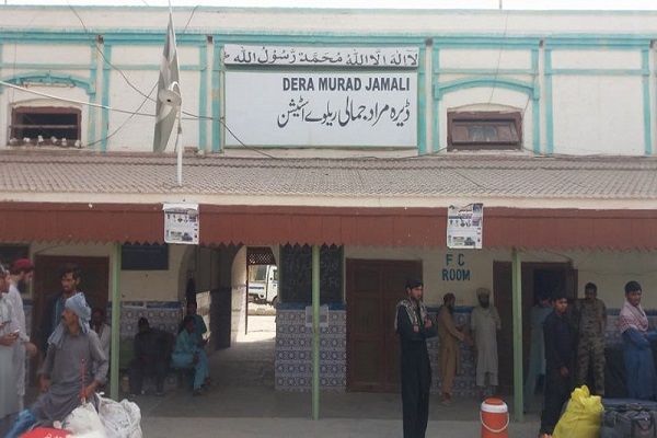
The National Highway (N-65) links this town to the rest of the country. Several bus services run in the city coming from all over the country. The town is also linked by a railroad to the rest of the country. Railway Station Dera Murad Jamali is situated in the central city.
Nearest airports to the main town are:
- Moenjodaro Airport (MJD), 27km
- Shahbaz Air Base (JAG), 37km
- Shikarpur Airport (SWV), 78 km
- Sui Airport (SUL), 94 km
Area and Postal Code
Postal Code: 80700
Area Code: 7050

