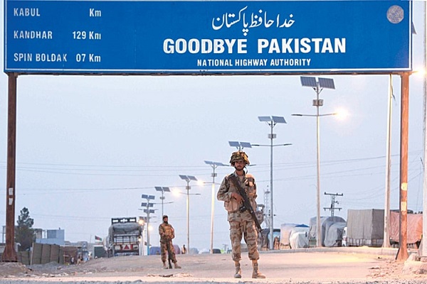
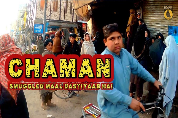
Chaman is a strategically important city situated in the northwest of Balochistan province, Pakistan. It is the administrative headquarter of Qilla Abdullah District, established in 1993 when it was separated from Pishin District. Chaman is also well-known for its Wesh–Chaman border crossing, which is 5 km from the central city.
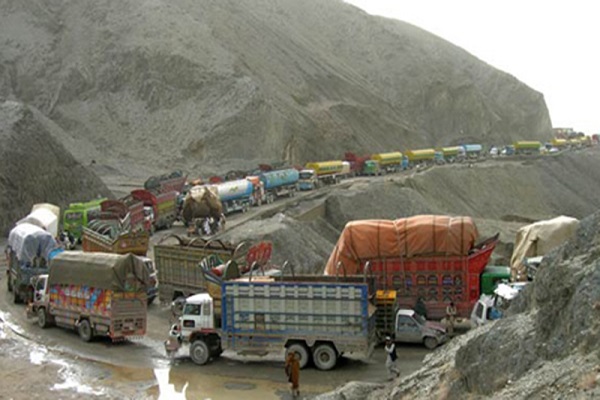
It is an international border crossing between Pakistan and Afghanistan, just like Wahga Crossing between Pakistan and India. The border is well-known as the main crossing point for Afghan refugees entering Pakistan after the Soviet invasion of Afghanistan in 1979.
The town borders Spin Boldak, the border town in Kandahar province of Afghanistan. This article has every detail about the region, including Chaman History.
| Title | Description |
|---|---|
| Information | |
| Location: | Pakistan |
| In Urdu : | چمن |
| City Council: | Government Of Balochistan |
| Type: | Capital of Qilla Abdullah District |
| Local Language Name: | China, Vietnam |
| Province: | Balochistan Pakistan |
| Coordinates : | 30°55′20″N 66°26′41″E |
| District: | Qilla Abdullah District |
| Region: | Balochistan |
| Elevation: | 1,338 m (4,390 ft) |
| Union councils: | 13 |
| Language | |
| Official Language: | Urdu |
| Native Language: | Balochi |
| Other Languages: | Urdu,Balochi,English |
| Government | |
| Type: | Government Of Balochistan |
| District Administrator: | Municipal Administration |
| Population | |
| Total Population: | 180,161 (2015) |
| Time zone | |
| Time zone: | PST (UTC+5) |
| Codes | |
| Postal code: | 86000 |
| Dialing code: | 826 |
| Vehicle registration: | Three letters beginning with C and random four numbers |
Table of Contents
Chaman History
Chaman is a historical place and dates back centuries. This territory was heavily used by Afghans, Mughals, and the British as a passage. Historian describes two legends associated with its name. One credits the town’s name to a Hindu merchant named Chaman Das, who frequently traveled in this town for trade.
Another tale narrates that this town received this name because of its lush green gardens or grass, as Chaman means Garden in the Persian language.
Khojak Tunnel
In 1891, Khojak (railway) Tunnel was constructed under the Khojak Pass to Qilla Abdullah with Chaman. It used to be the longest tunnel in South Asia until 2017.
In 1894, the British purchased 5604 acres of land from the locals for just Rs.5000. Their objective was to build a military station to attack Spin Boldak, a bordering town in Afghanistan, and then invade Afghanistan. But they never succeeded and remained in this region and established Chaman as a town.
Geography
Geographically the region is located at 30.55° N (latitude), 66.26° E (longitude), and 1,338 m. above sea level. Its total area is 5,264 km2 in length.
Chaman Climate
Due to its geographical terrain, Chaman experiences all weather. Its summers, almost four-months, are hot, clear, and dry. The average daily temperature varies from 0°C to 37°C.
Winters typically last for three-months with a daily temperature that ranges from 0°C to 11°C. On average, typically, 30.48mm of rainfall and 2.54mm of snowfall is recorded.

Population
The district is home to 123,191 people, according to the 2017 census. Its population density, 323.5/km2 (100/sq mi). Chaman city’s population makes it the 5th most populated city in Balochistan.
Chaman Culture
Because of its proximity to Afghanistan, a blend of traditional Baloch and Afghan cultural practices is evident in their art, music, and literature. Tribal attire, traditional cuisine (mostly meat-made), and hospitality are dominant in their society.
Chaman Education
Education in this region of Balochistan is gently flourishing as compared to other areas. Educational institutes in the region include:
- Al Hadi High Public School
- Citizen Educational Institute
- Educational Zone computer and science academy
- Eton Public High School
- C School & College
- Boy Degree College
- Model High School
- Iqra Asian International Public School
- Iqra Falah ul Atfal English School
- Tameer Nau Muslim Middle Public School
- Umeed English Public School, English Language, and Computer Academy
- Universal Public High School
Sports
People enjoy sports such as:
- Football
- Boxing
Football is the most favorite sport, and the town is well-known for football even before the partition of the subcontinent (since the 1940s). There are several football clubs in the city, and tournaments are regularly organized.
Chaman has produced several soccer players of national and international reputation. Several players have played for the Pakistan national football team, such as:
- Majeed Khan
- Jadid Khan
- Mehmood khan
- Dawood khan
- Saeed Khan
- Hayat Ullah
- Himmat Khan
- Kaleemullah
- Sadullah
- Muhammad Essa (former team captain)
Boxing is another popular sport in this region. In 2005, Mirwais Khan won a gold medal in Asian Junior Boxing Championship.

Economy
The region hosts millions of Afghan refugees. A significant portion of resources is drained towards their sustenance. Its economy primarily depends on agricultural products such as fruits and dry fruits. In the overall contribution to the economic growth of Pakistan, this town shares slightly.
Industry
Not many industries are located in this bordering town. However, several ice factories in the city are providing employment opportunities to the people in the region. Factories include:
- Hafiz Malak Ice Factroy
- Hajji Bacha Khan Ice Factroy
- Haji Sado Khan Ice Factroy
- Ice Faactroy Murda Karaz Road
- New Ice Factroy Rehman Kawol
- Old Ice Factory
Agriculture
The main occupation of the people is farming. Mountains are rugged and barren, but the fountains make the soil fertile and conducive for cultivating fruits and dry fruits. Lush green fields of fruits surrounded by majestic mountains mesmerize onlookers.
Chaman is well-known for its supreme quality of fruits such as plums, apricots, grapes, and peaches.
Tourism
Rugged and barren mountains, tribal lifestyle, and beautiful landscape make this region attractive for tourists. Worth visiting places near Chaman include:
- Bhag
- Dalbandin
- Dera-Bugti
- Dhadar
- Duki
- Garhi-Khairo
- Harnai
- Kalat
- Kharan
- Kohlu
- Loralai
- Mach
- Mastung
- Nushki
- Pishin
- Quetta
- Sibi
- Sohbatpur
- Surab
- Zehri
Chaman Languages
Various communities can speak and understand :
- Pashtun
- Balochi
- Urdu
Travel
National Highway N-25 links this region with the rest of the country. Transport services from all over Pakistan are available for travelers to Chaman. Chaman Bus Station is a famous spot for embarking and disembarking people traveling back and forth for this town.
The region can be reached by train. A network of railroads connects this town with other cities. The railway station is located in this city. Nearest airports to the city are:
- Quetta International Airport (UET), 87.01 km
- Nushki Airport (NHS), 160 km
- Naushki Airport (ICAO code: OPNK), 160 km
Chaman Postal Code
Postal Code: 86000
Area Code: 826

