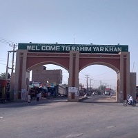
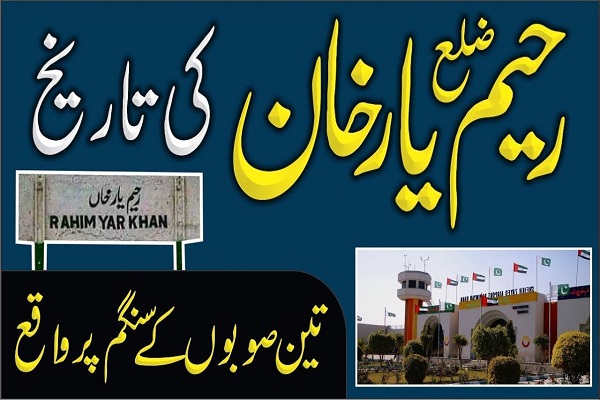
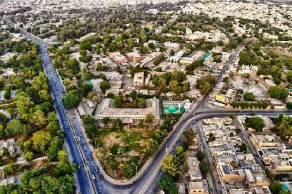
Rahim Yar Khan is located in Punjab province, Pakistan. The city is the R.Y.K. district’s administrative headquarter and is 588.2 km from the provincial capital, Lahore, and 786.9 km from Islamabad. It is situated at the confluence of three provinces (eastern Baluchistan, Southern Punjab, and Northern Sindh).
This strategic location makes the town hub of economic activities, agriculture, trade, education, health, and business. Even before the partition of the subcontinent, R.Y.K. was the second wealthiest state of united India. This city is also known as the gateway of Punjab for its trade routes and geographic location. This article contains all the detail about the city, including Rahim Yar Khan Biography.
| Title | Description |
|---|---|
| Information | |
| Location: | Pakistan |
| In Urdu : | رحیم یار خان |
| City Council: | Government of Punjab |
| Towns: | 4 |
| Type: | City in Punjab province |
| Local Language Name: | Urdu, Punjabi, Sindhi, Pashto |
| Province: | Punjab |
| Coordinates : | 28.42°N 70.30°E |
| District: | Rahim Yar Khan District |
| Website: | www.rahimyarkhan.com.pk |
| Region: | Punjab |
| Union councils: | 8 |
| Language | |
| Official Language: | Urdu |
| Native Language: | Punjabi |
| Other Languages: | Urdu.Punjabi.English |
| Government | |
| Type: | Government Of Punjab |
| Mayor: | Sardar Azhar Leghari |
| Area | |
| Total Area: | 45 km2 (17 sq mi) |
| Population | |
| Total Population: | 863,203 (2015) |
| Time zone | |
| Time zone: | PST (UTC+5) |
| Codes | |
| Postal code: | 64200 |
| Dialing code: | 068 |
| Vehicle registration: | Three letters beginning with R and random four numbers |
Table of Contents
Rahim Yar Khan History
Historians narrate that R.Y.K. was built in 1751 when province Sindh was under the Sumra Dynasty’s reign (the Rajput kingdom of Sindh). This town is located near River Indus and was formerly known as Noshehra. Around 800 years ago, while going to Multan, Muhammad Bin Qasim and his army used this region as a passageway to Multan.
Later this territory was under the rule of Shahab Uddin Ghori. During the reign of Sultan Shams Uddin Altamash, for 20 years, this region was under the control of insurgent groups. Sultan Mehmood Ghaznavi also used the area as the route to Somnath. In 1578, Salateen of Dehli conquered this region. Mughals later defeated them and made this part of their empire.
In 1809, Nawab Muhammad Sadiq Khan renamed the town Rahim Yar Khan. The city was designated as a District Headquarter in 1930. By the year 1940, it was already a thriving industrial zone. At the time of partition of the subcontinent in 1940-47, the nawab of R.Y.K. opted to join Pakistan.
Geography
Topographically the city is sited at 28°25′12″N (latitude) and 70°18′0″E (longitude), and its above sea level height (elevation) is 260 ft. (80 m).
Rahim Yar Khan Climate
Desert-like climate prevails in the city because of the geographical location and height above sea level. The typical yearly temperature is 26.2 °C, but in June, it could climb to 36°C. Usually, the month of January observes the minimum average temperature, and that is 13.3 °C. The average rainfall is around 101mm each year.
Population
The city is the permanent accommodation of 420,419 individuals as recorded in the 2017 census and is the 17th densely populated city in Pakistan and 10th in Punjab. Its population density is 9,300/km2 (24,000/ mi2).
Rahim Yar Khan Culture
The city is a multicultural society. In this small Pakistan, communities such as Punjabi, Saraiki, Sindhis, Pathans, Balochis, and others live side by side in peace and harmony. Ethnic groups celebrate all festivals. People are open-minded and straightforward.
People are fond of eating at home. Mostly they consume wheat bread, chopri roti (buttered bread), saag, daal, lassi, milk, butter, vegetables, beef, mutton with lots of onions, chilies, and pickles. Moreover, they are highly respectable towards elders. They touch their feet as a sign of respect and get the blessing from them in return.
The favorite dance of females is Giddha and of males is Bhangra, which is usually performed during special occasions.
Education
According to a survey conducted in 2017, the literacy rate is 71%. Academic institutes in the town are growing ever since the private sector has been involved in education. There are numerous educational institutions imparting education at various levels. Following are some of the educational institutions:
- Ali College of Engineering and Technology
- Al-Pine Degree College for Boys
- Al-Pine Degree College for Women
- Army Public School
- Beacon House School System
- Ali Post Graduate College of Education& Commerce
- Government Women Degree College
- Ali Post Graduate College of Commerce & Information
- Islamia University Bahawalpur
- Ali Garh College of Computer Science
- Khwaja Fareed Post-Graduate Government College
- Khwaja Fareed University of Engineering and Information Technology (KFUEIT)
- Lahore Grammar School
- NICAAS Post Graduate College
- Punjab Degree College for Boys & Girls
- Ranger Public School
- Shaikh Khalifa School
- Shaikh Zayed Public School
- Superior College of Science & Humanities
- Superior Degree College
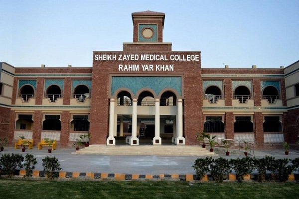
- Shaikh Zayed Medical College and Hospital
- SWOT Girls College
- The City School
Sports
People here are sports-loving. There are many facilities available in the town, including a cricket ground constructed in 1952 and famously known as Mehmood Stadium. The locals are keen to watch and fondly play:
- Badminton
- Cricket
- Football
- Kabaddi
- Hokey
- Tennis
- Volleyball
Economy
The city is located at a strategically important location, an intersection linking Punjab, Sindh, and Balochistan. Agroindustry, industrial, and manufacturing zones, markets, and the workforce are easily accessible by the three provinces as being the hub. Rahim Yar Khan is handsomely contributing its economic share in the GDP and economic progress of Pakistan.
Industry
The ideal locution (at the intersection of three provinces) makes it abundant in human resources and resources. Industries located at this intersection providing employment opportunities to the locals and the people of the neighboring regions. The industries are the primary sources of earnings for living. Some of the leading industrial units comprise:
- Agricultural Machinery Manufacturing
- Ceramics Industries
- Cotton Ginning & Weaving Industries
- Cooking Oil Factories
- Cottage Industries
- Fertilizer Mills
- Flour Mills
- Marble Factories
- Poultry Feed Units
- Sugar Mills
Some well-known units include:
- Ahmad Fine Textile Mill
- Ahmad Oriental Textile
- Coca Cola Beverage
- Fatima Fertilizers
- F.C. Fertilizers
- Haleeb Foods
- Hamza Sugar Mill
- Ittefaq Sugar Mill
- Ittihad Sugar Mill
- D.W. Sugar Mill
- Y.K. Sugar Mill
- Unilever
Agriculture
The city is one of the largest producers of crops in Punjab. The region is partitioned into three zones; the desert area (Cholistan), the canal irrigated area, and the riverside area (nearby the river Indus). The weather, geography, and soil are instrumental for many vegetables, fruits, and crop cultivation, such as wheat, dates, sugarcane, mango, malta, cotton, and rice.
Tourism
The town and its neighborhood are worth visiting, and it is gradually becoming a favorite tourist destination. Following are must-visit tourist places:
- Bagh-e-Bahisht
- Baghla Fort
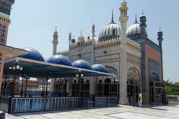
- Bhong Mosque
- Bhutta Wahan
- Bijnot Fort
- Desert of Rahim Yar Khan
- Desert Palace
- Islam Garh Fort
- Khair Garh Fort
- Mau Bubarik Fort
- Palace Sultan Of Abu Dhabi
- Pattan Minara
- Rahim Yar Khan Wildlife Park
Rahim Yar Khan Languages
The residents can communicate through:
- Saraiki
- Punjabi
- Riasti
- Urdu
- Sindhi
Travel
National Highway (N-5) and Motorway (M-5) provide a road link to reach the city. Numerous passenger-carrying transport services from all over Pakistan are available for by-road travelers to get R.Y.K.
Pakistan railway is running 26 train services for the city from different regions of Pakistan. Railroad travelers can embark and debark at Rahim Yar Khan railway station. Air routes from the outer regions could end up at Shaikh Zayed International Airport (R.Y.K.), located 6.5 km from the city center in Rahim Yar Khan.
Other nearest options include:
- Sukkur Airport (SKZ), Sukkur, 164 km
- Dera Ghazi Khan Airport (DEA), DIK, 175 km
- Bahawalpur Airport (BHV), Bahawalpur, 176 km
Rahim Yar Khan Postal Code
Postal Code: 64200
Area Code: 068
